
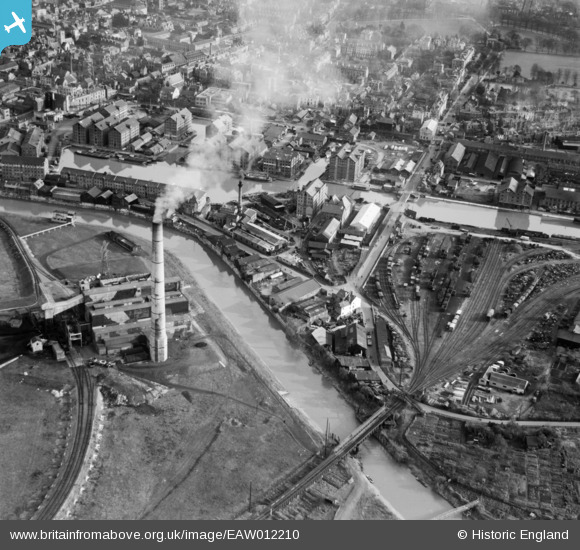
EAW012210 ENGLAND (1947). Gloucester Docks and the surrounding industrial area, Gloucester, 1947
© Copyright OpenStreetMap contributors and licensed by the OpenStreetMap Foundation. 2026. Cartography is licensed as CC BY-SA.
Nearby Images (25)
EAW012210

EAW021185

EAW021182

EAW018728

EAW021181

EAW021184

EAW012202

EPW037837

EAW012200

EPW037834

EAW012209

EPW037750

EPW037749

EAW012197

EAW012204

EAW021183

EPW037751

EAW012211

EAW012207

EPW024161

EAW021187

EPW048244

EPW038346

EPW038343

EPW024154

Details
| Title | [EAW012210] Gloucester Docks and the surrounding industrial area, Gloucester, 1947 |
| Reference | EAW012210 |
| Date | 13-November-1947 |
| Link | |
| Place name | GLOUCESTER |
| Parish | |
| District | |
| Country | ENGLAND |
| Easting / Northing | 382516, 218246 |
| Longitude / Latitude | -2.253926211275, 51.862081231927 |
| National Grid Reference | SO825182 |
Pins

Sparky |
Saturday 30th of September 2017 09:36:40 PM | |

MB |
Sunday 24th of November 2013 03:42:37 PM | |
|
MB |
Sunday 24th of November 2013 03:27:55 PM | |
|
MB |
Sunday 24th of November 2013 03:27:00 PM | |
|
MB |
Sunday 24th of November 2013 03:25:07 PM |