
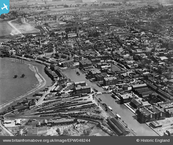
EPW048244 ENGLAND (1935). The Docks and the city, Gloucester, 1935. This image has been produced from a copy-negative.
© Copyright OpenStreetMap contributors and licensed by the OpenStreetMap Foundation. 2026. Cartography is licensed as CC BY-SA.
Nearby Images (20)
EPW048244

EAW012207

EPW024166

EPW037749

EPW024161

EAW012204

EAW018730

EAW012209

EPW037751

EAW012200

EAW012202

EPW024154

EPW024164

EPW037834

EPW037750

EAW021182

EPW024168

EAW012210

EAW012197

EPW037835

Details
| Title | [EPW048244] The Docks and the city, Gloucester, 1935. This image has been produced from a copy-negative. |
| Reference | EPW048244 |
| Date | July-1935 |
| Link | |
| Place name | GLOUCESTER |
| Parish | |
| District | |
| Country | ENGLAND |
| Easting / Northing | 382760, 218336 |
| Longitude / Latitude | -2.2503870439821, 51.862898094285 |
| National Grid Reference | SO828183 |
Pins

Class31 |
Wednesday 29th of October 2014 08:48:40 PM |
