
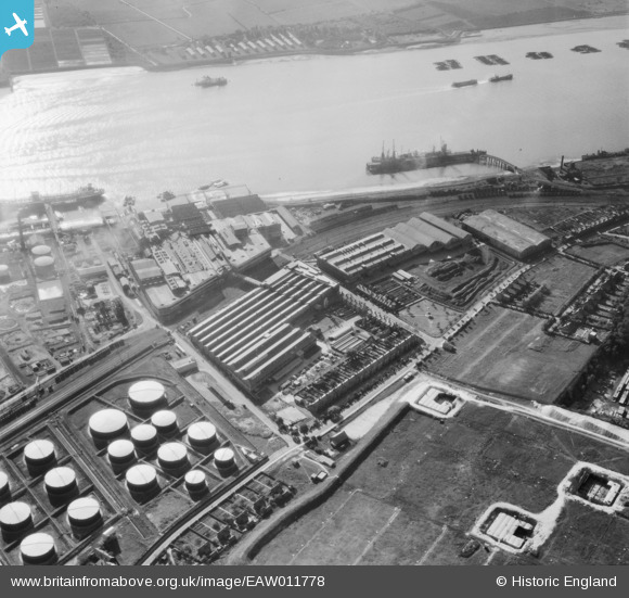
EAW011778 ENGLAND (1947). Thames Board Mills, Purfleet, 1947
© Copyright OpenStreetMap contributors and licensed by the OpenStreetMap Foundation. 2026. Cartography is licensed as CC BY-SA.
Nearby Images (32)
EAW011778

EAW011782

EAW010064

EAW011777

EAW010054

EAW010067

EAW011776

EAW011780

EAW010055

EAW010059

EAW011784

EAW010065

EAW010066

EAW011785

EAW010060

EAW011779

EAW010057

EAW010061

EAW010053

EAW011781

EAW010050

EAW011783

EAW010062

EAW010058

EAW050475

EAW010063

EAW050481

EAW010056

EAW050477

EAW050476

EAW050480

EAW050473

Details
| Title | [EAW011778] Thames Board Mills, Purfleet, 1947 |
| Reference | EAW011778 |
| Date | 9-October-1947 |
| Link | |
| Place name | PURFLEET |
| Parish | |
| District | |
| Country | ENGLAND |
| Easting / Northing | 555906, 177803 |
| Longitude / Latitude | 0.24529502883076, 51.477185814893 |
| National Grid Reference | TQ559778 |
Pins
Be the first to add a comment to this image!