
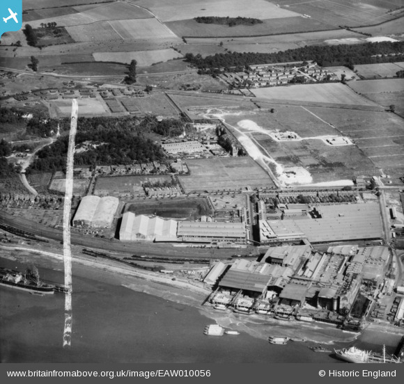
EAW010056 ENGLAND (1947). Thames Board Mills and environs, Purfleet, 1947. This image was marked by Aerofilms Ltd for photo editing.
© Copyright OpenStreetMap contributors and licensed by the OpenStreetMap Foundation. 2026. Cartography is licensed as CC BY-SA.
Nearby Images (24)
EAW010056

EAW050481

EAW050475

EAW050473

EAW050478

EAW050476

EAW050480

EAW050479

EAW050477

EAW050474

EAW010057

EAW010055

EAW010067

EAW010066

EAW011782

EAW030557

EPW026351

EAW011776

EAW011777

EAW011778

EAW030548

EAW010065

EAW010064

EAW030558

Details
| Title | [EAW010056] Thames Board Mills and environs, Purfleet, 1947. This image was marked by Aerofilms Ltd for photo editing. |
| Reference | EAW010056 |
| Date | 6-September-1947 |
| Link | |
| Place name | PURFLEET |
| Parish | |
| District | |
| Country | ENGLAND |
| Easting / Northing | 555883, 178023 |
| Longitude / Latitude | 0.24506116485671, 51.479168992863 |
| National Grid Reference | TQ559780 |
Pins
Be the first to add a comment to this image!