
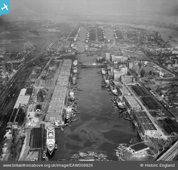
EAW008826 ENGLAND (1947). The Royal Docks, Canning Town, from the west, 1947
© Copyright OpenStreetMap contributors and licensed by the OpenStreetMap Foundation. 2026. Cartography is licensed as CC BY-SA.
Nearby Images (17)
EAW008826

EPW008889

EAW008819

EAW008823

EPW032933

EPW044120

EPW046150

EAW008820

EPW008886

EAW016655

EAW008816

EAW000053

EAW008824

EPR000001

EPW046155

EAW008821

EAW008817

Details
| Title | [EAW008826] The Royal Docks, Canning Town, from the west, 1947 |
| Reference | EAW008826 |
| Date | 9-August-1947 |
| Link | |
| Place name | CANNING TOWN |
| Parish | |
| District | |
| Country | ENGLAND |
| Easting / Northing | 540441, 180607 |
| Longitude / Latitude | 0.023847850194405, 51.506436692417 |
| National Grid Reference | TQ404806 |
Pins

MB |
Sunday 17th of November 2013 07:21:39 PM |