
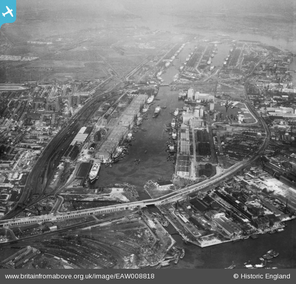
EAW008818 ENGLAND (1947). The Royal Docks, Silvertown, from the west, 1947
© Copyright OpenStreetMap contributors and licensed by the OpenStreetMap Foundation. 2026. Cartography is licensed as CC BY-SA.
Nearby Images (20)
EAW008818

EAW009065

EAW000038

EPW055963

EAW009064

EPW005645

EPW055967

EAW008824

EPW055968

EPW055964

EPW055966

EPW059394

EPW059395

EPW055961

EPW055965

EPW055959

EPW055962

EPW046155

EPW059393

EAW008817

Details
| Title | [EAW008818] The Royal Docks, Silvertown, from the west, 1947 |
| Reference | EAW008818 |
| Date | 9-August-1947 |
| Link | |
| Place name | SILVERTOWN |
| Parish | |
| District | |
| Country | ENGLAND |
| Easting / Northing | 540027, 180476 |
| Longitude / Latitude | 0.017833799406402, 51.50536215821 |
| National Grid Reference | TQ400805 |

