
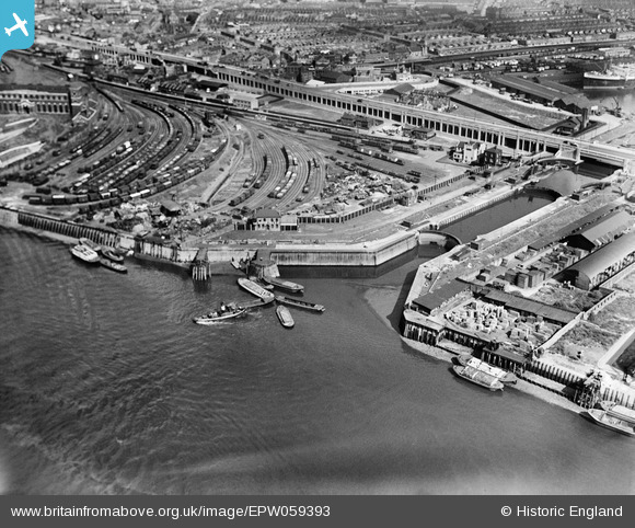
EPW059393 ENGLAND (1938). The Thames Wharf and Lock, Canning Town, 1938
© Copyright OpenStreetMap contributors and licensed by the OpenStreetMap Foundation. 2026. Cartography is licensed as CC BY-SA.
Nearby Images (18)
EPW059393

EPW055959

EPW055962

EPW055965

EPW055966

EPW055961

EPW055964

EPW055960

EPW059394

EPW055967

EPW059395

EPW055968

EPW055963

EPW059454

EPW005645

EAW009065

EAW008818

EPW006146

Details
| Title | [EPW059393] The Thames Wharf and Lock, Canning Town, 1938 |
| Reference | EPW059393 |
| Date | 15-September-1938 |
| Link | |
| Place name | CANNING TOWN |
| Parish | |
| District | |
| Country | ENGLAND |
| Easting / Northing | 539799, 180389 |
| Longitude / Latitude | 0.014515941782464, 51.50463675104 |
| National Grid Reference | TQ398804 |
Pins

Class31 |
Monday 16th of March 2015 02:24:35 PM |
