
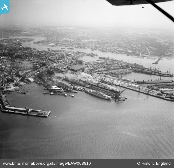
EAW008810 ENGLAND (1947). The docks, Southampton, from the south-west, 1947
© Copyright OpenStreetMap contributors and licensed by the OpenStreetMap Foundation. 2026. Cartography is licensed as CC BY-SA.
Nearby Images (15)
EAW008810

EPW041072

EPW000238

EPW020445

EPW041070

EAW001361

EAW001355

EAW015268

EAW033413

EPW037430

EPW041073

EPW041039
 formation flying over Kingswood, Sanderstead, from the east, 1933")
EPW041069

EPW009070

EPW037408

Details
| Title | [EAW008810] The docks, Southampton, from the south-west, 1947 |
| Reference | EAW008810 |
| Date | 9-August-1947 |
| Link | |
| Place name | SOUTHAMPTON |
| Parish | |
| District | |
| Country | ENGLAND |
| Easting / Northing | 442022, 110308 |
| Longitude / Latitude | -1.4024865504961, 50.890172473225 |
| National Grid Reference | SU420103 |
Pins

redmist |
Thursday 8th of December 2022 09:27:39 PM | |
|
redmist |
Thursday 8th of December 2022 09:27:13 PM | |
|
redmist |
Thursday 8th of December 2022 09:26:46 PM | |
|
redmist |
Thursday 8th of December 2022 09:25:39 PM | |
|
redmist |
Thursday 8th of December 2022 09:25:07 PM |