
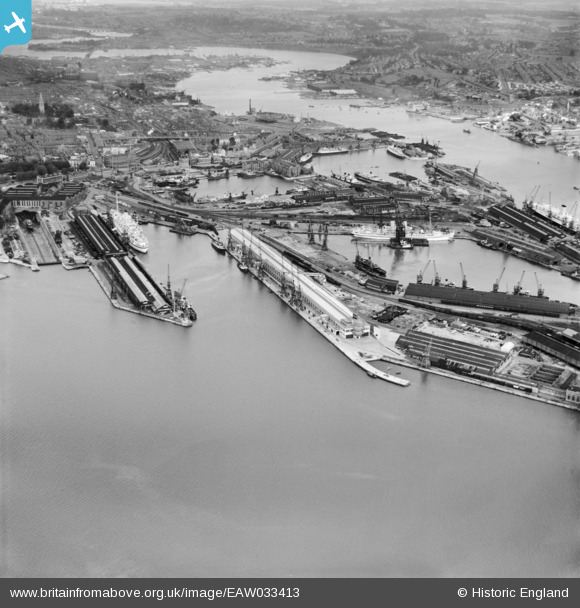
EAW033413 ENGLAND (1950). The Docks, Southampton, from the south-west, 1950
© Copyright OpenStreetMap contributors and licensed by the OpenStreetMap Foundation. 2026. Cartography is licensed as CC BY-SA.
Nearby Images (20)
EAW033413

EPW041070

EPW037408

EPW032343

EPW009070

EPW000238

EAW051594

EAW046509

EAW008810

EAW035248

EPW041072

EAW051593

EPW037407

EAW035250

EPW009069

EAW001371
 in Ocean Dock, Southampton, 1946")
EAW033412

EAW033407

EAW033429

EAW035249

Details
| Title | [EAW033413] The Docks, Southampton, from the south-west, 1950 |
| Reference | EAW033413 |
| Date | 10-October-1950 |
| Link | |
| Place name | SOUTHAMPTON |
| Parish | |
| District | |
| Country | ENGLAND |
| Easting / Northing | 442171, 110137 |
| Longitude / Latitude | -1.4003877776085, 50.88862381561 |
| National Grid Reference | SU422101 |
Pins

chainbull |
Monday 16th of February 2015 04:53:59 PM |