
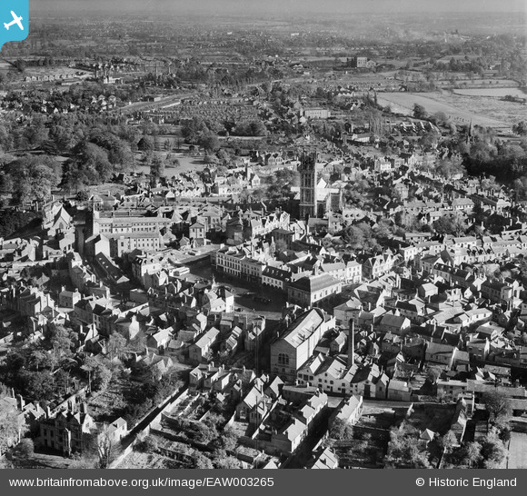
EAW003265 ENGLAND (1946). The town centre, Warwick, from the west, 1946
© Copyright OpenStreetMap contributors and licensed by the OpenStreetMap Foundation. 2026. Cartography is licensed as CC BY-SA.
Nearby Images (18)
EAW003265

EAW024691

EPW019742

EPW000407

EPW053229

EPW000410

EPW035695

EAW024695

EPW000412

EAW042926

EAW024692

EPW000403

EAW042928

EAW003264

EPW019741

EAW042927

EPW000409

EAW003655

Details
| Title | [EAW003265] The town centre, Warwick, from the west, 1946 |
| Reference | EAW003265 |
| Date | 4-November-1946 |
| Link | |
| Place name | WARWICK |
| Parish | WARWICK |
| District | |
| Country | ENGLAND |
| Easting / Northing | 428000, 264959 |
| Longitude / Latitude | -1.589515876357, 52.281667868054 |
| National Grid Reference | SP280650 |
Pins

Keith |
Tuesday 17th of November 2020 05:28:37 PM | |
|
Keith |
Tuesday 17th of November 2020 05:27:55 PM |