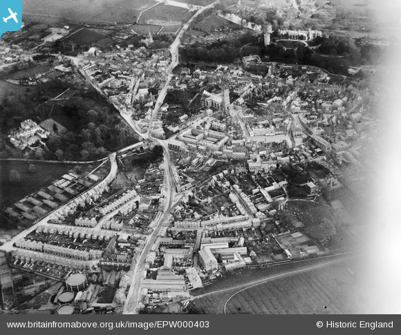
EPW000403 ENGLAND (1920). Warwick, from the north-west, 1920
© Copyright OpenStreetMap contributors and licensed by the OpenStreetMap Foundation. 2026. Cartography is licensed as CC BY-SA.
Nearby Images (6)
Details
| Title | [EPW000403] Warwick, from the north-west, 1920 |
| Reference | EPW000403 |
| Date | April-1920 |
| Link | |
| Place name | WARWICK |
| Parish | WARWICK |
| District | |
| Country | ENGLAND |
| Easting / Northing | 427888, 265145 |
| Longitude / Latitude | -1.5911423755058, 52.283345904385 |
| National Grid Reference | SP279651 |
Pins

morbidthepoet |
Saturday 29th of June 2024 04:50:35 PM | |

morbidthepoet |
Saturday 29th of June 2024 04:40:13 PM | |

morbidthepoet |
Saturday 29th of June 2024 04:29:57 PM | |

morbidthepoet |
Saturday 29th of June 2024 04:28:58 PM | |

morbidthepoet |
Saturday 29th of June 2024 04:28:38 PM | |

morbidthepoet |
Saturday 29th of June 2024 04:26:50 PM | |

Dekk |
Thursday 10th of November 2022 01:02:01 PM | |

Nicholas Ball |
Wednesday 19th of April 2017 03:34:59 PM |


![[EPW000403] Warwick, from the north-west, 1920](http://britainfromabove.org.uk/sites/all/libraries/aerofilms-images/public/100x100/EPW/000/EPW000403.jpg)
![[EPW000407] Priory Park, Warwick, from the south-west, 1920](http://britainfromabove.org.uk/sites/all/libraries/aerofilms-images/public/100x100/EPW/000/EPW000407.jpg)
![[EAW003265] The town centre, Warwick, from the west, 1946](http://britainfromabove.org.uk/sites/all/libraries/aerofilms-images/public/100x100/EAW/003/EAW003265.jpg)
![[EAW024691] St Mary's Church, Warwick Castle and the town centre, Warwick, from the north-west, 1949](http://britainfromabove.org.uk/sites/all/libraries/aerofilms-images/public/100x100/EAW/024/EAW024691.jpg)
![[EPW019742] The Market Place and the town centre, Warwick, 1927](http://britainfromabove.org.uk/sites/all/libraries/aerofilms-images/public/100x100/EPW/019/EPW019742.jpg)
![[EPW000410] Warwick, from the south-west, 1920](http://britainfromabove.org.uk/sites/all/libraries/aerofilms-images/public/100x100/EPW/000/EPW000410.jpg)