
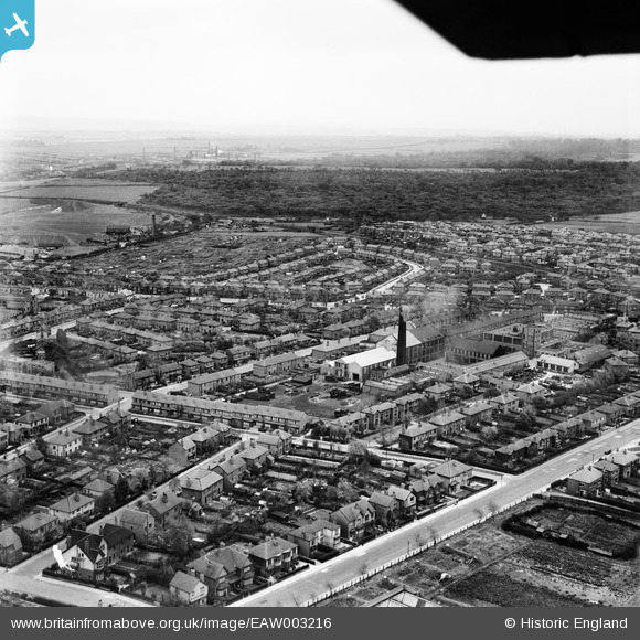
EAW003216 ENGLAND (1946). Residential streets surrounding Grove Hall Mills, Beeston, from the north-west, 1946
© Copyright OpenStreetMap contributors and licensed by the OpenStreetMap Foundation. 2026. Cartography is licensed as CC BY-SA.
Nearby Images (21)
EAW003216

EAW003209

EAW003218

EAW003213

EAW002619

EAW002620

EAW003207

EAW003212

EAW003206

EAW002618

EAW003211

EAW003210

EAW003214

EAW003215

EAW003217

EAW003208

EAW051497

EAW051501

EAW002617

EAW051499

EAW051496

Details
| Title | [EAW003216] Residential streets surrounding Grove Hall Mills, Beeston, from the north-west, 1946 |
| Reference | EAW003216 |
| Date | 18-October-1946 |
| Link | |
| Place name | BEESTON |
| Parish | |
| District | |
| Country | ENGLAND |
| Easting / Northing | 428969, 430191 |
| Longitude / Latitude | -1.5604658789895, 53.767041123578 |
| National Grid Reference | SE290302 |
