
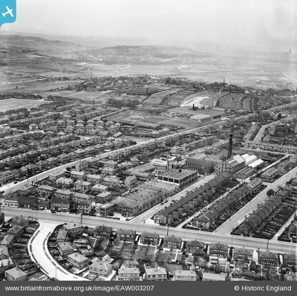
EAW003207 ENGLAND (1946). Grove Hall Mills and environs, Beeston, from the south-east, 1946
© Copyright OpenStreetMap contributors and licensed by the OpenStreetMap Foundation. 2026. Cartography is licensed as CC BY-SA.
Nearby Images (19)
EAW003207

EAW003212

EAW002620

EAW002618

EAW003213

EAW003215

EAW003210

EAW003214

EAW002619

EAW003211

EAW003217

EAW003208

EAW003206

EAW003218

EAW003216

EAW003209

EAW002617

EAW051499

EAW051501

Details
| Title | [EAW003207] Grove Hall Mills and environs, Beeston, from the south-east, 1946 |
| Reference | EAW003207 |
| Date | 18-October-1946 |
| Link | |
| Place name | BEESTON |
| Parish | |
| District | |
| Country | ENGLAND |
| Easting / Northing | 428964, 430077 |
| Longitude / Latitude | -1.5605524399992, 53.766016678953 |
| National Grid Reference | SE290301 |
Pins

redmist |
Monday 15th of November 2021 11:41:35 PM | |
|
redmist |
Monday 15th of November 2021 11:34:47 PM | |
|
redmist |
Monday 15th of November 2021 11:34:25 PM | |
|
redmist |
Tuesday 15th of October 2019 09:21:56 AM | |

Sparky |
Thursday 14th of September 2017 11:01:03 PM |