
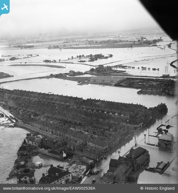
EAW002538A ENGLAND (1946). A large area of flooding around Castleford Locks, Castleford, from the south-east, 1946
© Copyright OpenStreetMap contributors and licensed by the OpenStreetMap Foundation. 2025. Cartography is licensed as CC BY-SA.
Nearby Images (8)
EAW002538A

EAW002533

EAW002544

EAW002534

EAW002540

EAW002542

EAW002551

EAW002539

Details
| Title | [EAW002538A] A large area of flooding around Castleford Locks, Castleford, from the south-east, 1946 |
| Reference | EAW002538A |
| Date | 21-September-1946 |
| Link | |
| Place name | CASTLEFORD |
| Parish | |
| District | |
| Country | ENGLAND |
| Easting / Northing | 442830, 426137 |
| Longitude / Latitude | -1.350733460438, 53.729646293826 |
| National Grid Reference | SE428261 |
Pins

Derekdye |
Sunday 17th of November 2013 08:38:59 PM | |
|
Derekdye |
Sunday 17th of November 2013 08:38:12 PM | |
|
Derekdye |
Sunday 17th of November 2013 08:35:55 PM | |
|
Derekdye |
Sunday 17th of November 2013 08:34:33 PM |