
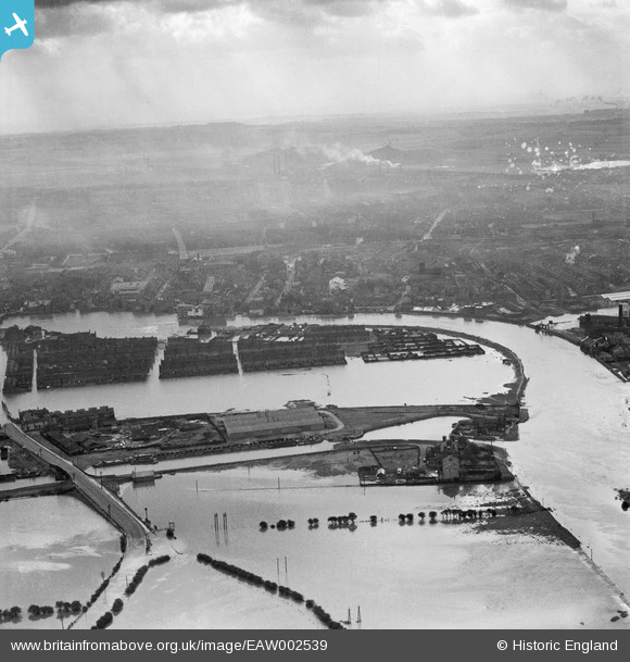
EAW002539 ENGLAND (1946). A large area of flooding around Castleford Locks, Castleford, from the north, 1946
© Copyright OpenStreetMap contributors and licensed by the OpenStreetMap Foundation. 2025. Cartography is licensed as CC BY-SA.
Nearby Images (4)
EAW002539

EAW002551

EAW002534

EAW002538A

Details
| Title | [EAW002539] A large area of flooding around Castleford Locks, Castleford, from the north, 1946 |
| Reference | EAW002539 |
| Date | 21-September-1946 |
| Link | |
| Place name | CASTLEFORD |
| Parish | |
| District | |
| Country | ENGLAND |
| Easting / Northing | 442595, 426282 |
| Longitude / Latitude | -1.3542756398619, 53.730968878806 |
| National Grid Reference | SE426263 |
Pins

Derekdye |
Sunday 12th of January 2014 10:25:34 PM | |
|
Derekdye |
Sunday 12th of January 2014 10:24:42 PM | |
|
Derekdye |
Sunday 12th of January 2014 10:23:32 PM | |
|
Derekdye |
Sunday 12th of January 2014 10:22:43 PM | |
|
Derekdye |
Sunday 12th of January 2014 10:21:44 PM | |
|
Derekdye |
Sunday 12th of January 2014 10:19:11 PM |