
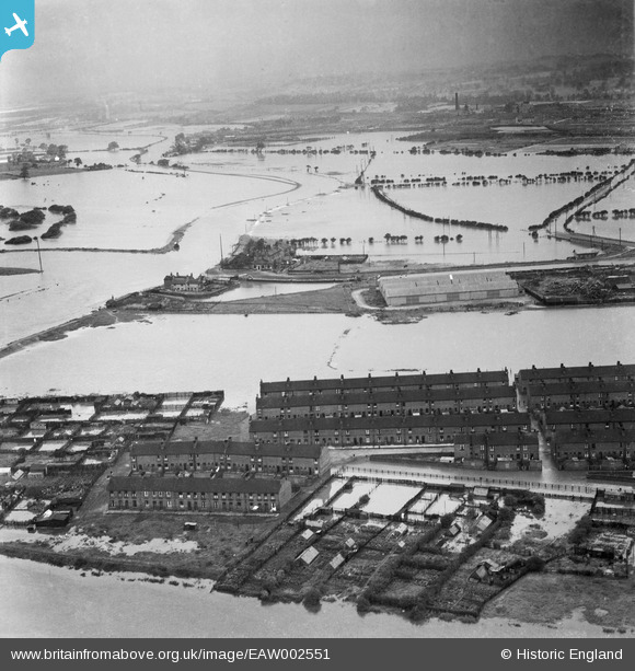
EAW002551 ENGLAND (1946). A large area of flooding around Castleford Locks, Castleford, from the south-east, 1946
© Copyright OpenStreetMap contributors and licensed by the OpenStreetMap Foundation. 2025. Cartography is licensed as CC BY-SA.
Nearby Images (5)
EAW002551

EAW002534

EAW002539

EAW002538A

EAW002533

Details
| Title | [EAW002551] A large area of flooding around Castleford Locks, Castleford, from the south-east, 1946 |
| Reference | EAW002551 |
| Date | 21-September-1946 |
| Link | |
| Place name | CASTLEFORD |
| Parish | |
| District | |
| Country | ENGLAND |
| Easting / Northing | 442604, 426109 |
| Longitude / Latitude | -1.3541630462235, 53.729413125619 |
| National Grid Reference | SE426261 |
Pins
Be the first to add a comment to this image!