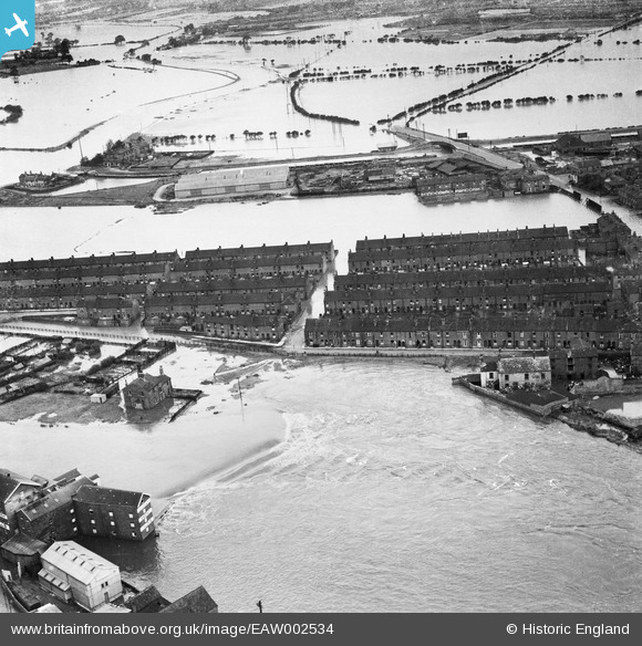
EAW002534 ENGLAND (1946). A large area of flooding centred upon Mill Lane, Castleford, 1946
© Copyright OpenStreetMap contributors and licensed by the OpenStreetMap Foundation. 2025. Cartography is licensed as CC BY-SA.
Nearby Images (8)
EAW002534

EAW002538A

EAW002533

EAW002544

EAW002551

EAW002540

EAW002539

EAW002542

Details
| Title | [EAW002534] A large area of flooding centred upon Mill Lane, Castleford, 1946 |
| Reference | EAW002534 |
| Date | 21-September-1946 |
| Link | |
| Place name | CASTLEFORD |
| Parish | |
| District | |
| Country | ENGLAND |
| Easting / Northing | 442763, 426095 |
| Longitude / Latitude | -1.3517548596161, 53.729274273131 |
| National Grid Reference | SE428261 |