
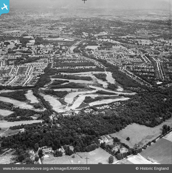
EAW002094 ENGLAND (1946). Addington Golf Course and environs, Spring Park, 1946
© Copyright OpenStreetMap contributors and licensed by the OpenStreetMap Foundation. 2026. Cartography is licensed as CC BY-SA.
Nearby Images (27)
EAW002094

EAW002093

EAW002090

EAW002091

EAW004322

EAW002099

EAW002089

EAW004318

EAW002097

EAW004323

EAW002098

EAW002095

EAW051809

EAW002096

EAW051802

EAW051805

EAW051808

EAW004319

EAW004320

EAW051810

EAW002092

EAW051806

EAW004316

EAW004324

EAW004321

EAW051803

EAW051804

Details
| Title | [EAW002094] Addington Golf Course and environs, Spring Park, 1946 |
| Reference | EAW002094 |
| Date | 2-August-1946 |
| Link | |
| Place name | SPRING PARK |
| Parish | |
| District | |
| Country | ENGLAND |
| Easting / Northing | 537395, 164999 |
| Longitude / Latitude | -0.026076176886888, 51.366912670268 |
| National Grid Reference | TQ374650 |
Pins
Be the first to add a comment to this image!