
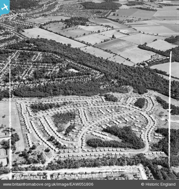
EAW051806 ENGLAND (1953). The Shrublands estate of prefabricated houses on land previously forming part of Addington Golf Course, Shirley, 1953 This image was marked by Aerofilms Ltd for photo editing.
© Copyright OpenStreetMap contributors and licensed by the OpenStreetMap Foundation. 2026. Cartography is licensed as CC BY-SA.
Nearby Images (17)
EAW051806

EAW004324

EAW002098

EAW051802

EAW004322

EAW051804

EAW051805

EAW002091

EAW002093

EAW051808

EAW002094

EAW002099

EAW002090

EAW004318

EAW004323

EAW002096

EAW004320

Details
| Title | [EAW051806] The Shrublands estate of prefabricated houses on land previously forming part of Addington Golf Course, Shirley, 1953 This image was marked by Aerofilms Ltd for photo editing. |
| Reference | EAW051806 |
| Date | 1-September-1953 |
| Link | |
| Place name | SHIRLEY |
| Parish | |
| District | |
| Country | ENGLAND |
| Easting / Northing | 537598, 165009 |
| Longitude / Latitude | -0.023157712341185, 51.366953388654 |
| National Grid Reference | TQ376650 |
Pins

Terry the Carpet Estimator |
Saturday 16th of December 2017 06:14:17 PM |