
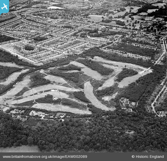
EAW002089 ENGLAND (1946). Addington Golf Course and Spring Park housing development, Spring Park, 1946
© Copyright OpenStreetMap contributors and licensed by the OpenStreetMap Foundation. 2026. Cartography is licensed as CC BY-SA.
Nearby Images (24)
EAW002089

EAW002097

EAW002090

EAW004323

EAW002094

EAW002093

EAW002099

EAW051809

EAW002095

EAW004318

EAW002091

EAW004322

EAW002092

EAW004319

EAW002096

EAW004320

EAW004321

EAW002098

EAW051808

EAW051810

EAW051802

EAW051805

EAW004316

EAW051803

Details
| Title | [EAW002089] Addington Golf Course and Spring Park housing development, Spring Park, 1946 |
| Reference | EAW002089 |
| Date | 2-August-1946 |
| Link | |
| Place name | SPRING PARK |
| Parish | |
| District | |
| Country | ENGLAND |
| Easting / Northing | 537334, 164975 |
| Longitude / Latitude | -0.026961265235347, 51.366711729872 |
| National Grid Reference | TQ373650 |
Pins

Matt Aldred edob.mattaldred.com |
Sunday 8th of November 2020 10:29:30 PM | |
|
Matt Aldred edob.mattaldred.com |
Tuesday 5th of May 2020 09:13:00 PM | |

cptpies |
Friday 8th of February 2019 11:37:59 AM | |
|
Richard Watson |
Sunday 25th of January 2015 09:46:09 AM |