
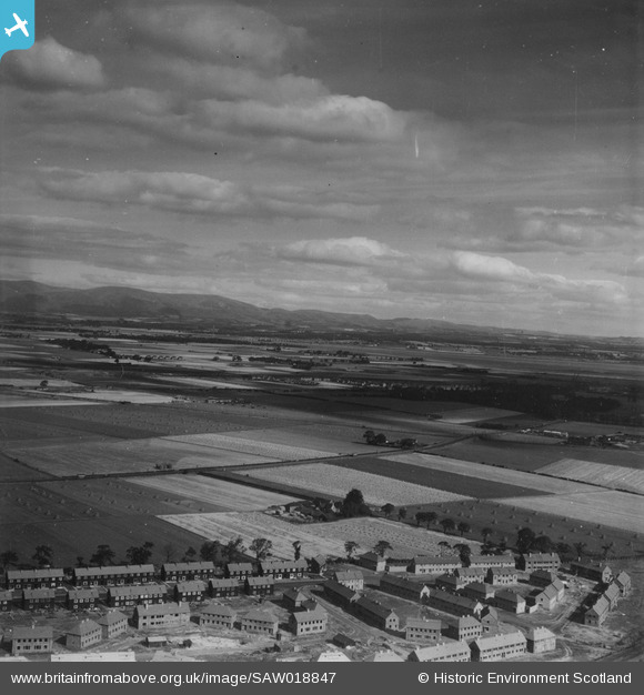
SAW018847 SCOTLAND (1948). Falkirk, general view, showing Montgomery Street and West Mains. An oblique aerial photograph taken facing north. This image has been produced from a print.
© Hawlfraint cyfranwyr OpenStreetMap a thrwyddedwyd gan yr OpenStreetMap Foundation. 2026. Trwyddedir y gartograffeg fel CC BY-SA.
Manylion
| Pennawd | [SAW018847] Falkirk, general view, showing Montgomery Street and West Mains. An oblique aerial photograph taken facing north. This image has been produced from a print. |
| Cyfeirnod | SAW018847 |
| Dyddiad | 1948 |
| Dolen | NRHE Collection item 1314894 |
| Enw lle | |
| Plwyf | FALKIRK |
| Ardal | FALKIRK |
| Gwlad | SCOTLAND |
| Dwyreiniad / Gogleddiad | 290757, 681362 |
| Hydred / Lledred | -3.7524423067395, 56.012766194147 |
| Cyfeirnod Grid Cenedlaethol | NS908814 |
Pinnau

Mike Holder |
Friday 23rd of October 2020 11:45:44 AM | |
|
Mike Holder |
Friday 23rd of October 2020 11:44:10 AM | |
|
Mike Holder |
Friday 23rd of October 2020 11:41:28 AM | |
|
Mike Holder |
Friday 23rd of October 2020 11:39:06 AM | |
|
Mike Holder |
Friday 23rd of October 2020 11:36:09 AM | |
|
Mike Holder |
Friday 23rd of October 2020 11:34:16 AM | |
|
Speed |
Wednesday 10th of September 2014 10:31:17 PM | |
|
Alex Buchanan |
Monday 30th of June 2014 09:45:47 PM | |
|
buchanan |
Friday 14th of June 2013 06:47:31 PM | |
|
buchanan |
Friday 14th of June 2013 06:45:45 PM | |
I think this was Westfield farm. The fire station is on the same patch, but further south. |
Alex Buchanan |
Monday 30th of June 2014 09:41:56 PM |
|
buchanan |
Friday 14th of June 2013 06:42:51 PM | |
|
buchanan |
Friday 14th of June 2013 06:39:53 PM | |
|
buchanan |
Thursday 30th of May 2013 12:13:13 AM | |
|
buchanan |
Thursday 30th of May 2013 12:12:01 AM | |
Yes it is the low bog and it is Montgomery Street to be precise and again if you look it is just like a building site, so they're just building it. |
Alex Buchanan |
Monday 30th of June 2014 09:44:43 PM |
|
buchanan |
Thursday 30th of May 2013 12:09:05 AM |