
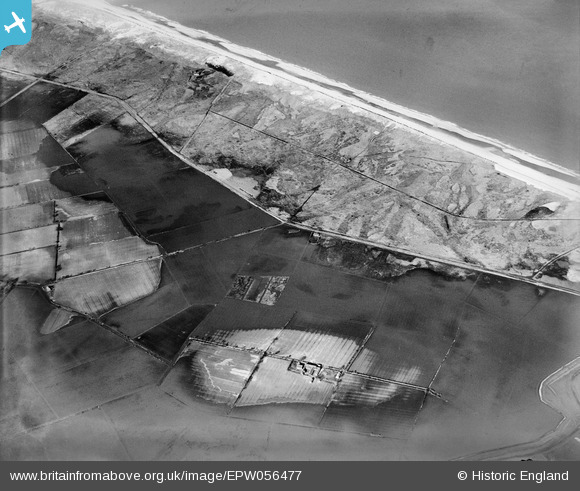
EPW056477 ENGLAND (1938). Flooding around Ford's Farm, Horsey, 1938
© Hawlfraint cyfranwyr OpenStreetMap a thrwyddedwyd gan yr OpenStreetMap Foundation. 2026. Trwyddedir y gartograffeg fel CC BY-SA.
Manylion
| Pennawd | [EPW056477] Flooding around Ford's Farm, Horsey, 1938 |
| Cyfeirnod | EPW056477 |
| Dyddiad | 12-March-1938 |
| Dolen | |
| Enw lle | HORSEY |
| Plwyf | HORSEY |
| Ardal | |
| Gwlad | ENGLAND |
| Dwyreiniad / Gogleddiad | 646937, 322852 |
| Hydred / Lledred | 1.6591854155018, 52.746430295482 |
| Cyfeirnod Grid Cenedlaethol | TG469229 |
Pinnau
 |

incony |
Friday 5th of April 2019 01:22:22 PM |