
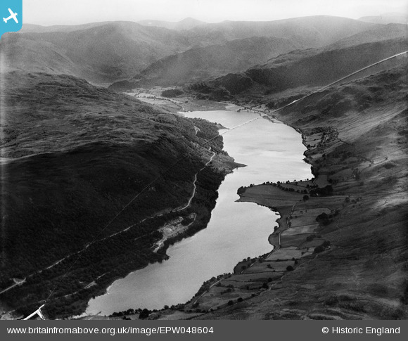
EPW048604 ENGLAND (1935). Low Water and High Water (Haweswater Reservoir) and surrounding countryside, Naddle Forest, from the north-east, 1935. This image has been produced from a damaged negative.
© Hawlfraint cyfranwyr OpenStreetMap a thrwyddedwyd gan yr OpenStreetMap Foundation. 2026. Trwyddedir y gartograffeg fel CC BY-SA.
Manylion
| Pennawd | [EPW048604] Low Water and High Water (Haweswater Reservoir) and surrounding countryside, Naddle Forest, from the north-east, 1935. This image has been produced from a damaged negative. |
| Cyfeirnod | EPW048604 |
| Dyddiad | July-1935 |
| Dolen | |
| Enw lle | NADDLE FOREST |
| Plwyf | SHAP RURAL |
| Ardal | |
| Gwlad | ENGLAND |
| Dwyreiniad / Gogleddiad | 349409, 515248 |
| Hydred / Lledred | -2.7818423722259, 54.529853673218 |
| Cyfeirnod Grid Cenedlaethol | NY494152 |
Pinnau
Byddwch y cyntaf i ychwanegu sylw at y ddelwedd hon!