
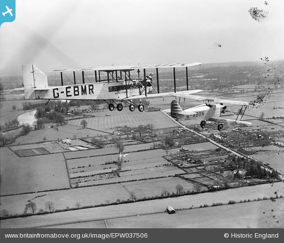
EPW037506 ENGLAND. Bray, G-EBMR and G-ABBN of the National Aviation Day Display team in flight, 1932. This image has been produced from a damaged negative.
© Hawlfraint cyfranwyr OpenStreetMap a thrwyddedwyd gan yr OpenStreetMap Foundation. 2026. Trwyddedir y gartograffeg fel CC BY-SA.
Manylion
| Pennawd | [EPW037506] Bray, G-EBMR and G-ABBN of the National Aviation Day Display team in flight, 1932. This image has been produced from a damaged negative. |
| Cyfeirnod | EPW037506 |
| Dyddiad | |
| Dolen | |
| Enw lle | BRAY |
| Plwyf | BRAY |
| Ardal | |
| Gwlad | ENGLAND |
| Dwyreiniad / Gogleddiad | 491044, 178263 |
| Hydred / Lledred | -0.68834562650528, 51.495484883994 |
| Cyfeirnod Grid Cenedlaethol | SU910783 |
Pinnau

Class31 |
Wednesday 12th of December 2012 07:54:30 PM | |
|
Class31 |
Wednesday 12th of December 2012 07:48:52 PM | |
|
Class31 |
Wednesday 12th of December 2012 07:48:30 PM | |
|
Class31 |
Monday 10th of December 2012 01:36:34 PM | |
|
Class31 |
Monday 10th of December 2012 01:29:36 PM |
Cyfraniadau Grŵp
I have checked the houses along Windsor Road and they match those in the photograph. I am confident in this identification. |
Class31 |
Wednesday 2nd of January 2013 03:58:45 PM |
Thanks Class31, we'll update this image in the catalogue and post the new data here in due course. Yours, Katy Britain from Above Cataloguing Team Leader |
Katy Whitaker |
Wednesday 2nd of January 2013 03:58:45 PM |
Windsor Road at junction with Monkey Island Lane Map Reference SU912779 |
Class31 |
Monday 10th of December 2012 01:27:12 PM |
Eureka |
Class31 |
Monday 10th of December 2012 01:25:24 PM |