
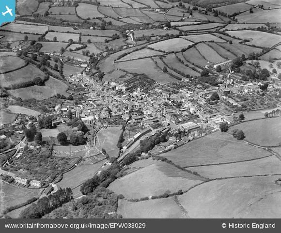
EPW033029 ENGLAND (1930). The town and surrounding countryside, Ashburton, from the south, 1930
© Hawlfraint cyfranwyr OpenStreetMap a thrwyddedwyd gan yr OpenStreetMap Foundation. 2026. Trwyddedir y gartograffeg fel CC BY-SA.
Manylion
| Pennawd | [EPW033029] The town and surrounding countryside, Ashburton, from the south, 1930 |
| Cyfeirnod | EPW033029 |
| Dyddiad | July-1930 |
| Dolen | |
| Enw lle | ASHBURTON |
| Plwyf | ASHBURTON |
| Ardal | |
| Gwlad | ENGLAND |
| Dwyreiniad / Gogleddiad | 275664, 69561 |
| Hydred / Lledred | -3.7538257630229, 50.512023419286 |
| Cyfeirnod Grid Cenedlaethol | SX757696 |
Pinnau

Gasometerman |
Sunday 9th of August 2020 06:01:13 PM | |
|
Treecutter75 |
Tuesday 6th of August 2013 05:49:53 PM | |
|
Treecutter75 |
Tuesday 6th of August 2013 05:45:33 PM | |
|
Treecutter75 |
Tuesday 6th of August 2013 05:44:32 PM | |
|
Treecutter75 |
Tuesday 6th of August 2013 05:43:57 PM | |
|
Treecutter75 |
Tuesday 6th of August 2013 05:42:20 PM |
Cyfraniadau Grŵp
How it looked before being ruined by the A38. |
Treecutter75 |
Friday 8th of March 2013 05:37:23 PM |
Ashburton Railway Station & Goods yard. |
Treecutter75 |
Friday 8th of March 2013 05:32:59 PM |