
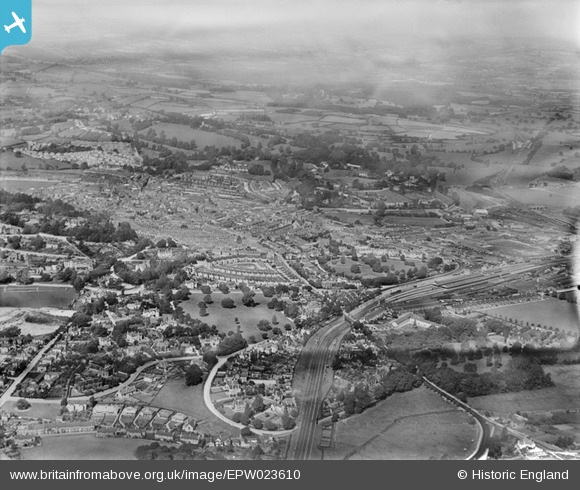
EPW023610 ENGLAND (1928). The town, Newton Abbot, from the south-east, 1928
© Hawlfraint cyfranwyr OpenStreetMap a thrwyddedwyd gan yr OpenStreetMap Foundation. 2026. Trwyddedir y gartograffeg fel CC BY-SA.
Manylion
| Pennawd | [EPW023610] The town, Newton Abbot, from the south-east, 1928 |
| Cyfeirnod | EPW023610 |
| Dyddiad | September-1928 |
| Dolen | |
| Enw lle | NEWTON ABBOT |
| Plwyf | NEWTON ABBOT |
| Ardal | |
| Gwlad | ENGLAND |
| Dwyreiniad / Gogleddiad | 286794, 70721 |
| Hydred / Lledred | -3.597251285043, 50.524711144557 |
| Cyfeirnod Grid Cenedlaethol | SX868707 |
Pinnau
 Grade I Listed Old Forde House. Grade I Listed Old Forde House. |

Paul |
Wednesday 16th of September 2026 04:43:16 PM |
| Railway line that ran up the Teign Valley to Heathfield, where there was a branch to a terminus at Moreton Hampstead, and then via Longdown and Ide to rejoin the main line south of Exeter. The line From Exeter to Christow closed in 1958. From Christow to Heathfield closed after flooding in 1961. The section from Newton Abbot to Heathfield remains for occasional goods traffic. |
John W |
Monday 6th of June 2016 09:13:16 PM |
| Newton Abbot west signal box only in use for a few weeks at time of photograph. Opened July 1928,costing 1,300 pounds to construct, and containg 153 levers. This and East box replaced 4 boxes during the remodelling of the station. 62ft long but only 11ft wide closed 02nd May 1987. |
Nowy Paul |
Sunday 27th of March 2016 12:06:50 PM |
| Great Western Railway station following major rebuilding during the previous few years. |
Nowy Paul |
Sunday 27th of March 2016 11:59:33 AM |