
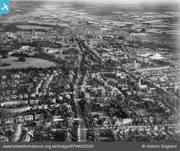
EPW022536 ENGLAND (1928). Banbury Road and environs, Oxford, from the north, 1928
© Hawlfraint cyfranwyr OpenStreetMap a thrwyddedwyd gan yr OpenStreetMap Foundation. 2026. Trwyddedir y gartograffeg fel CC BY-SA.
Manylion
| Pennawd | [EPW022536] Banbury Road and environs, Oxford, from the north, 1928 |
| Cyfeirnod | EPW022536 |
| Dyddiad | 11-August-1928 |
| Dolen | |
| Enw lle | OXFORD |
| Plwyf | |
| Ardal | |
| Gwlad | ENGLAND |
| Dwyreiniad / Gogleddiad | 451041, 207796 |
| Hydred / Lledred | -1.2602833503791, 51.766061340683 |
| Cyfeirnod Grid Cenedlaethol | SP510078 |
Pinnau
Byddwch y cyntaf i ychwanegu sylw at y ddelwedd hon!