
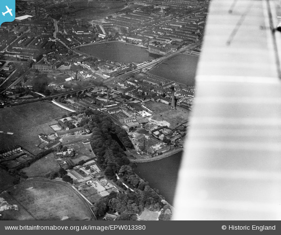
EPW013380 ENGLAND (1925). Railway viaduct and reservoirs, Accrington, 1925
© Hawlfraint cyfranwyr OpenStreetMap a thrwyddedwyd gan yr OpenStreetMap Foundation. 2026. Trwyddedir y gartograffeg fel CC BY-SA.
Manylion
| Pennawd | [EPW013380] Railway viaduct and reservoirs, Accrington, 1925 |
| Cyfeirnod | EPW013380 |
| Dyddiad | June-1925 |
| Dolen | |
| Enw lle | ACCRINGTON |
| Plwyf | |
| Ardal | |
| Gwlad | ENGLAND |
| Dwyreiniad / Gogleddiad | 374186, 428153 |
| Hydred / Lledred | -2.391495570161, 53.748887753698 |
| Cyfeirnod Grid Cenedlaethol | SD742282 |
Pinnau

wadey |
Friday 24th of October 2025 07:08:24 PM | |
|
wadey |
Friday 24th of October 2025 07:04:07 PM | |
|
wadey |
Friday 24th of October 2025 05:11:13 PM | |
|
wadey |
Friday 24th of October 2025 05:09:08 PM | |
|
wadey |
Friday 24th of October 2025 05:08:33 PM |
Cyfraniadau Grŵp
This is not Accrington. The viaduct in Accrington has 19 stone arches and forms an S shape curve. |
Tetbury |
Thursday 2nd of May 2013 04:39:11 PM |
Hi Tetbury, The railway viaduct referenced by the caption is just west of Church and Oswaldtwistle station. The general area of the photo might be better known locally as Alleytroyds or Foxhill Bank, perhaps. However, neither of those names are in the Ordnance Survey 1:50000 Gazetteer of placenames. This Gazetteer forms the database of placenames that this website uses, which means that the placenames that are used in these records must come from the 250,000 or so in listed the Gazetteer. I hope this explains why this image uses "Accrington". Yours, Katy Britain from Above Cataloguing Team Leader |
Katy Whitaker |
Thursday 2nd of May 2013 04:39:11 PM |
This is Church Viaduct and Station, with Steiner's reservoirs either side of the Railway line. |
Highwayman |
Saturday 7th of July 2012 05:04:44 PM |