
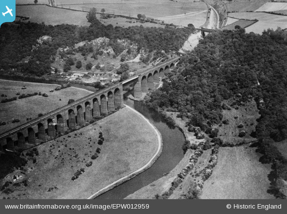
EPW012959 ENGLAND (1925). Conisbrough Viaduct, Conisbrough, 1925. This image has been produced from a copy-negative.
© Hawlfraint cyfranwyr OpenStreetMap a thrwyddedwyd gan yr OpenStreetMap Foundation. 2026. Trwyddedir y gartograffeg fel CC BY-SA.
Manylion
| Pennawd | [EPW012959] Conisbrough Viaduct, Conisbrough, 1925. This image has been produced from a copy-negative. |
| Cyfeirnod | EPW012959 |
| Dyddiad | June-1925 |
| Dolen | |
| Enw lle | CONISBROUGH |
| Plwyf | CONISBROUGH PARKS |
| Ardal | |
| Gwlad | ENGLAND |
| Dwyreiniad / Gogleddiad | 452510, 399328 |
| Hydred / Lledred | -1.2085258599013, 53.48779055784 |
| Cyfeirnod Grid Cenedlaethol | SK525993 |
Pinnau
Byddwch y cyntaf i ychwanegu sylw at y ddelwedd hon!