
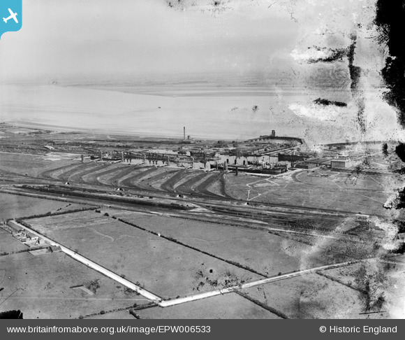
EPW006533 ENGLAND (1921). The Docks and the River Humber, Immingham Dock, from the south, 1921
© Hawlfraint cyfranwyr OpenStreetMap a thrwyddedwyd gan yr OpenStreetMap Foundation. 2026. Trwyddedir y gartograffeg fel CC BY-SA.
Manylion
| Pennawd | [EPW006533] The Docks and the River Humber, Immingham Dock, from the south, 1921 |
| Cyfeirnod | EPW006533 |
| Dyddiad | June-1921 |
| Dolen | |
| Enw lle | IMMINGHAM DOCK |
| Plwyf | IMMINGHAM |
| Ardal | |
| Gwlad | ENGLAND |
| Dwyreiniad / Gogleddiad | 519621, 415033 |
| Hydred / Lledred | -0.19136100648076, 53.617923406986 |
| Cyfeirnod Grid Cenedlaethol | TA196150 |
Pinnau

DaveH |
Monday 5th of October 2020 03:04:57 PM |
Cyfraniadau Grŵp
Kings Road running from the mid left of the picture with the last few blocks of the terraces (Still standing) from the sharp turn towards the docks it is Queens Road. Most of this area now is Industrial. |
Andy Donkin |
Tuesday 26th of June 2012 04:43:23 PM |