
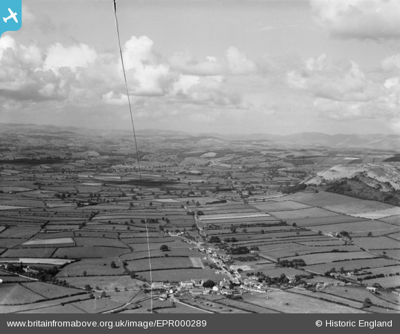
EPR000289 ENGLAND (1934). The village and the surrounding Cumbrian landscape, Holme, from the south, 1934. This image has been produced from a damaged negative.
© Hawlfraint cyfranwyr OpenStreetMap a thrwyddedwyd gan yr OpenStreetMap Foundation. 2026. Trwyddedir y gartograffeg fel CC BY-SA.
Manylion
| Pennawd | [EPR000289] The village and the surrounding Cumbrian landscape, Holme, from the south, 1934. This image has been produced from a damaged negative. |
| Cyfeirnod | EPR000289 |
| Dyddiad | 30-August-1934 |
| Dolen | |
| Enw lle | HOLME |
| Plwyf | HOLME |
| Ardal | |
| Gwlad | ENGLAND |
| Dwyreiniad / Gogleddiad | 352589, 479456 |
| Hydred / Lledred | -2.7269983269528, 54.208483313925 |
| Cyfeirnod Grid Cenedlaethol | SD526795 |
Pinnau

Lion Crissy |
Friday 27th of November 2020 01:59:53 PM |