
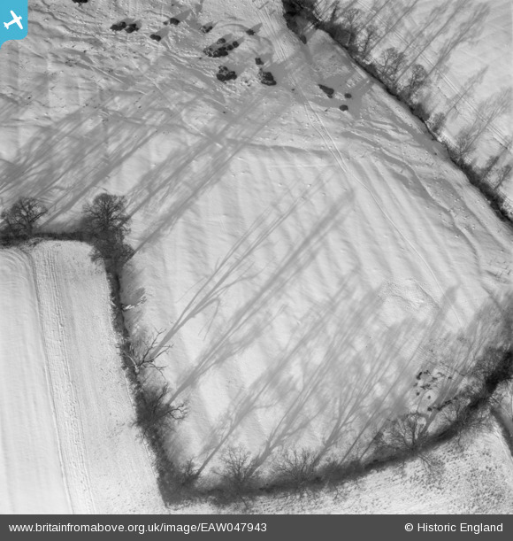
EAW047943 ENGLAND (1952). Snow covered fields, Horton-cum-Studley, 1952
© Hawlfraint cyfranwyr OpenStreetMap a thrwyddedwyd gan yr OpenStreetMap Foundation. 2026. Trwyddedir y gartograffeg fel CC BY-SA.
Manylion
| Pennawd | [EAW047943] Snow covered fields, Horton-cum-Studley, 1952 |
| Cyfeirnod | EAW047943 |
| Dyddiad | 1-December-1952 |
| Dolen | |
| Enw lle | HORTON-CUM-STUDLEY |
| Plwyf | HORTON-CUM-STUDLEY |
| Ardal | |
| Gwlad | ENGLAND |
| Dwyreiniad / Gogleddiad | 459908, 212892 |
| Hydred / Lledred | -1.1309120684746, 51.811000862657 |
| Cyfeirnod Grid Cenedlaethol | SP599129 |
Pinnau
Byddwch y cyntaf i ychwanegu sylw at y ddelwedd hon!
Cyfraniadau Grŵp
This field is situated northwest of Studley Farm, southwest of Tippens Copse and north of Moors Farm. The field shape can still be seen. On Google you can see the bumps in the field which match those in the aerial photo. Is this evidence of medieval ploughing? The wavy line in the snow going up the right hand side of the image can be seen on google image. |

Class31 |
Monday 30th of June 2014 04:09:38 PM |
Hi Class31, Thanks for the useful information; you're looking at medieval ridge and furrow. We'll update the catalogue and post the new location data here in due course. Yours, Katy Britain from Above Cataloguing Team Leader |
Katy Whitaker |
Monday 30th of June 2014 04:09:38 PM |