
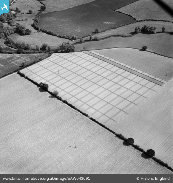
EAW043691 ENGLAND (1952). Fields on the north bank of the River Colne, Fordham, 1952
© Hawlfraint cyfranwyr OpenStreetMap a thrwyddedwyd gan yr OpenStreetMap Foundation. 2025. Trwyddedir y gartograffeg fel CC BY-SA.
Manylion
| Pennawd | [EAW043691] Fields on the north bank of the River Colne, Fordham, 1952 |
| Cyfeirnod | EAW043691 |
| Dyddiad | 4-June-1952 |
| Dolen | |
| Enw lle | FORDHAM |
| Plwyf | FORDHAM |
| Ardal | |
| Gwlad | ENGLAND |
| Dwyreiniad / Gogleddiad | 592317, 227210 |
| Hydred / Lledred | 0.79630419047193, 51.909734851337 |
| Cyfeirnod Grid Cenedlaethol | TL923272 |
Pinnau
 Matt Aldred edob.mattaldred.com |
Thursday 18th of February 2021 05:54:13 PM | |
Matt Aldred edob.mattaldred.com |
Thursday 18th of February 2021 05:53:24 PM | |
 TomRobin |
Thursday 3rd of July 2014 09:48:07 AM | |
TomRobin |
Thursday 3rd of July 2014 09:33:46 AM |
Cyfraniadau Grŵp
Looking SE over the River Colne at Ford Street. Curved fence line still evident |
TomRobin |
Monday 11th of August 2014 11:27:55 AM |
Thanks TomRobin, we’ll update the catalogue with your new location and post the new data here in due course. Yours, Katy Britain from Above Cataloguing Team Leader |
Katy Whitaker |
Monday 11th of August 2014 11:27:55 AM |
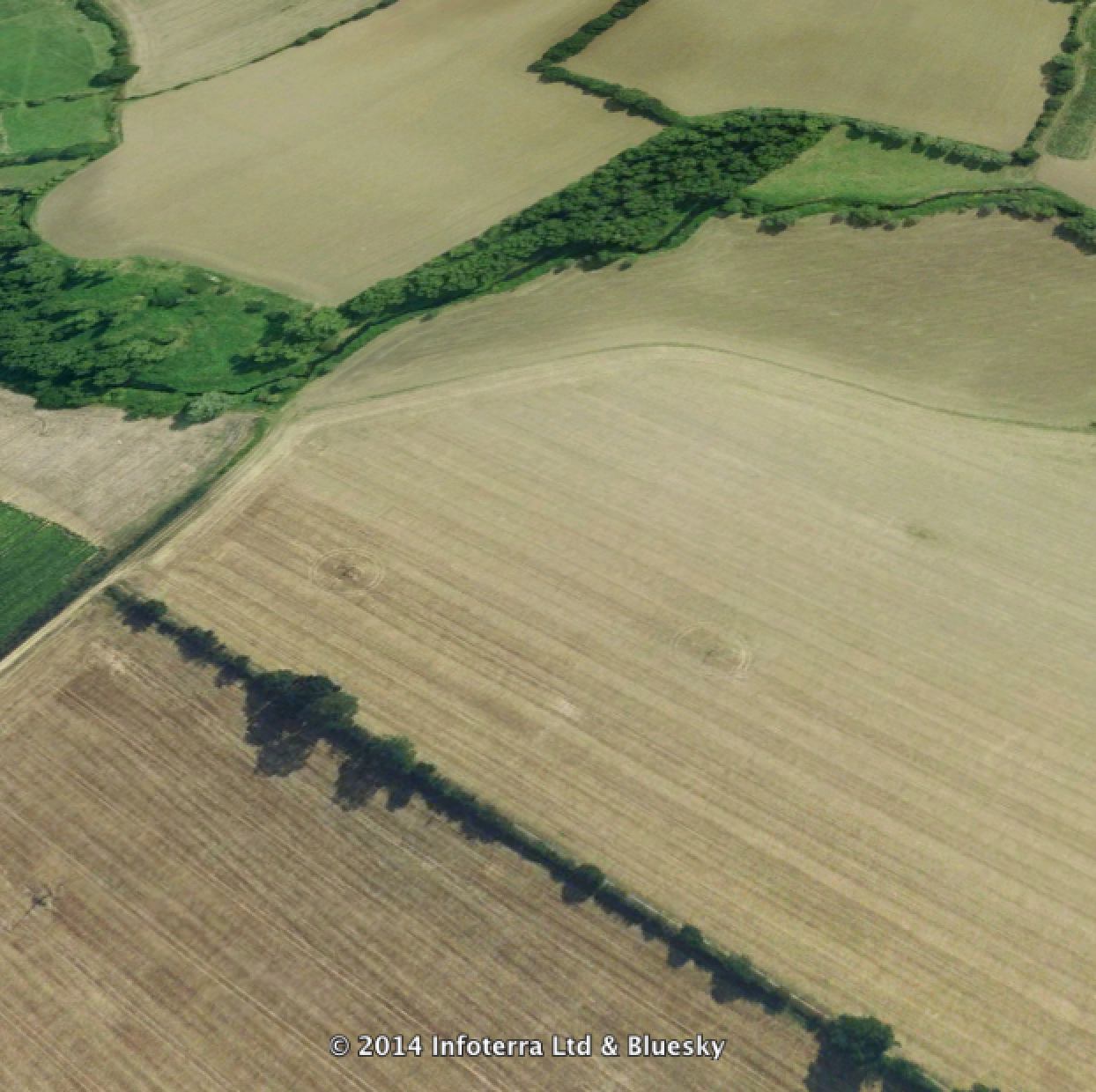 View as in 2000 |
TomRobin |
Thursday 3rd of July 2014 09:46:29 AM |