
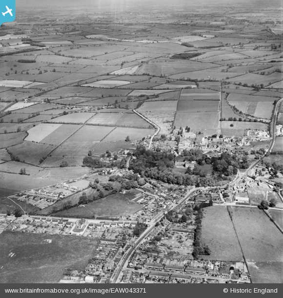
EAW043371 ENGLAND (1952). The village, Brixworth, from the south, 1952
© Hawlfraint cyfranwyr OpenStreetMap a thrwyddedwyd gan yr OpenStreetMap Foundation. 2026. Trwyddedir y gartograffeg fel CC BY-SA.
Manylion
| Pennawd | [EAW043371] The village, Brixworth, from the south, 1952 |
| Cyfeirnod | EAW043371 |
| Dyddiad | 13-May-1952 |
| Dolen | |
| Enw lle | BRIXWORTH |
| Plwyf | BRIXWORTH |
| Ardal | |
| Gwlad | ENGLAND |
| Dwyreiniad / Gogleddiad | 474761, 270560 |
| Hydred / Lledred | -0.902842267133, 52.327646925961 |
| Cyfeirnod Grid Cenedlaethol | SP748706 |
Pinnau

gBr |
Thursday 27th of April 2017 12:34:19 PM | |
|
MB |
Thursday 27th of April 2017 10:00:44 AM | |
Wikipedia has an entry: https://en.wikipedia.org/wiki/All_Saints%27_Church,_Brixworth |
MB |
Thursday 27th of April 2017 10:05:36 AM |
|
James Chandler |
Wednesday 26th of April 2017 09:06:32 PM |