
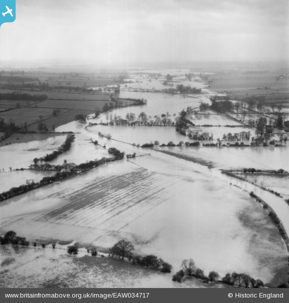
EAW034717 ENGLAND (1951). The River Chelmer in flood, Little Baddow, from the west, 1951.
© Hawlfraint cyfranwyr OpenStreetMap a thrwyddedwyd gan yr OpenStreetMap Foundation. 2026. Trwyddedir y gartograffeg fel CC BY-SA.
Manylion
| Pennawd | [EAW034717] The River Chelmer in flood, Little Baddow, from the west, 1951. |
| Cyfeirnod | EAW034717 |
| Dyddiad | 21-February-1951 |
| Dolen | |
| Enw lle | LITTLE BADDOW |
| Plwyf | LITTLE BADDOW |
| Ardal | |
| Gwlad | ENGLAND |
| Dwyreiniad / Gogleddiad | 578788, 209213 |
| Hydred / Lledred | 0.59051964450074, 51.752579127246 |
| Cyfeirnod Grid Cenedlaethol | TL788092 |
Pinnau

Class31 |
Tuesday 23rd of December 2014 02:13:55 PM | |
|
Class31 |
Tuesday 23rd of December 2014 02:12:17 PM | |
 |

Dye |
Wednesday 12th of November 2014 04:20:08 PM |
Very well done DYE. |
Ian |
Saturday 24th of January 2015 02:23:41 PM |
Cyfraniadau Grŵp
Could this be the River Chelmer at Little Baddow - facing west? There is a bend in the river and field boundaries there that seem to match... |
Rockmanda |
Saturday 24th of January 2015 02:22:25 PM |
Looks good to me. |
Class31 |
Tuesday 23rd of December 2014 02:15:34 PM |
looks like you are spot on ROCKMANDA, well done for finding that. |
Ian |
Saturday 24th of January 2015 02:22:25 PM |
I have discounted the River Thames for this one and I am looking at rivers such as the Nene and the Great Ouse but I've drawn a blank so far. |
Class31 |
Wednesday 28th of May 2014 03:33:37 PM |
EAW043718 is of Albertopolis, South Kensington, 1951 taken on the same day. |
Class31 |
Wednesday 28th of May 2014 03:19:45 PM |
EAW034716 is of The River Thames in flood at Thames Ditton Island, Thames Ditton, 1951 |
Class31 |
Wednesday 28th of May 2014 03:17:57 PM |