
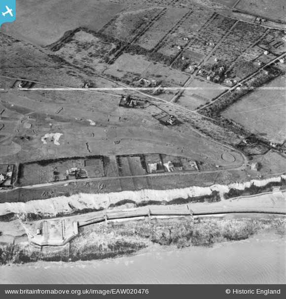
EAW020476 ENGLAND (1948). Walmer and Kingsdown Golf Links above the Royal Marines Rifle Range at the cliff bottom, Kingsdown, 1948. This image was marked by Aerofilms Ltd for photo editing.
© Hawlfraint cyfranwyr OpenStreetMap a thrwyddedwyd gan yr OpenStreetMap Foundation. 2026. Trwyddedir y gartograffeg fel CC BY-SA.
Manylion
| Pennawd | [EAW020476] Walmer and Kingsdown Golf Links above the Royal Marines Rifle Range at the cliff bottom, Kingsdown, 1948. This image was marked by Aerofilms Ltd for photo editing. |
| Cyfeirnod | EAW020476 |
| Dyddiad | 9-November-1948 |
| Dolen | |
| Enw lle | KINGSDOWN |
| Plwyf | RINGWOULD WITH KINGSDOWN |
| Ardal | |
| Gwlad | ENGLAND |
| Dwyreiniad / Gogleddiad | 637867, 147417 |
| Hydred / Lledred | 1.4035232228466, 51.175905080494 |
| Cyfeirnod Grid Cenedlaethol | TR379474 |
Pinnau

Matt Aldred edob.mattaldred.com |
Monday 30th of November 2020 08:55:48 PM | |

Chris Kolonko |
Saturday 16th of September 2017 08:15:41 PM | |
|
Chris Kolonko |
Saturday 16th of September 2017 08:15:12 PM |