
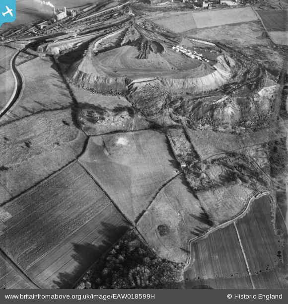
EAW018599H ENGLAND (1948). Spoil heaps near Park Ings Farm, Flixborough, 1948. This image has been produced from a damaged negative.
© Hawlfraint cyfranwyr OpenStreetMap a thrwyddedwyd gan yr OpenStreetMap Foundation. 2026. Trwyddedir y gartograffeg fel CC BY-SA.
Manylion
| Pennawd | [EAW018599H] Spoil heaps near Park Ings Farm, Flixborough, 1948. This image has been produced from a damaged negative. |
| Cyfeirnod | EAW018599H |
| Dyddiad | 10-September-1948 |
| Dolen | |
| Enw lle | FLIXBOROUGH |
| Plwyf | FLIXBOROUGH |
| Ardal | |
| Gwlad | ENGLAND |
| Dwyreiniad / Gogleddiad | 487632, 414171 |
| Hydred / Lledred | -0.67510101982554, 53.616507349857 |
| Cyfeirnod Grid Cenedlaethol | SE876142 |
