
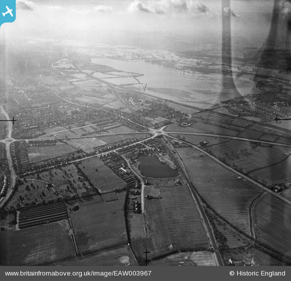
EAW003967 ENGLAND (1947). The Wolvercote Roundabout and flooding at Wolvercote Common and Port Meadow, Wolvercote, from the north-east, 1947. This image has been produced from a damaged negative.
© Hawlfraint cyfranwyr OpenStreetMap a thrwyddedwyd gan yr OpenStreetMap Foundation. 2026. Trwyddedir y gartograffeg fel CC BY-SA.
Manylion
| Pennawd | [EAW003967] The Wolvercote Roundabout and flooding at Wolvercote Common and Port Meadow, Wolvercote, from the north-east, 1947. This image has been produced from a damaged negative. |
| Cyfeirnod | EAW003967 |
| Dyddiad | 20-March-1947 |
| Dolen | |
| Enw lle | WOLVERCOTE |
| Plwyf | |
| Ardal | |
| Gwlad | ENGLAND |
| Dwyreiniad / Gogleddiad | 449871, 210603 |
| Hydred / Lledred | -1.2768348435012, 51.791405561919 |
| Cyfeirnod Grid Cenedlaethol | SP499106 |
