
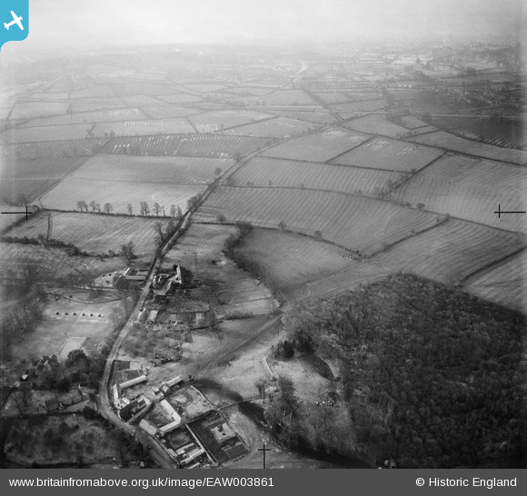
EAW003861 ENGLAND (1947). Hill Farm and surrounding countryside, Elsfield, from the north, 1947
© Hawlfraint cyfranwyr OpenStreetMap a thrwyddedwyd gan yr OpenStreetMap Foundation. 2026. Trwyddedir y gartograffeg fel CC BY-SA.
Manylion
| Pennawd | [EAW003861] Hill Farm and surrounding countryside, Elsfield, from the north, 1947 |
| Cyfeirnod | EAW003861 |
| Dyddiad | 20-March-1947 |
| Dolen | |
| Enw lle | ELSFIELD |
| Plwyf | ELSFIELD |
| Ardal | |
| Gwlad | ENGLAND |
| Dwyreiniad / Gogleddiad | 453864, 209902 |
| Hydred / Lledred | -1.2190479361909, 51.784732372838 |
| Cyfeirnod Grid Cenedlaethol | SP539099 |
Pinnau

tima |
Friday 19th of April 2019 08:26:40 AM |