
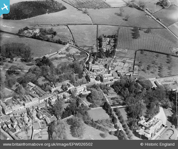
EPW026502 ENGLAND (1929). St Andrew's Church and environs, Ampthill, 1929
© Copyright OpenStreetMap contributors and licensed by the OpenStreetMap Foundation. 2024. Cartography is licensed as CC BY-SA.
Nearby Images (6)
EPW026502

EPW035871

EPW026497

EPW026504

EPW026500

EAW037765

Details
| Title | [EPW026502] St Andrew's Church and environs, Ampthill, 1929 |
| Reference | EPW026502 |
| Date | May-1929 |
| Link | |
| Place name | AMPTHILL |
| Parish | AMPTHILL |
| District | |
| Country | ENGLAND |
| Easting / Northing | 503689, 238260 |
| Longitude / Latitude | -0.48832479275272, 52.032620130773 |
| National Grid Reference | TL037383 |
Pins
 melgibbs |
Monday 20th of January 2014 07:51:17 PM | |
melgibbs |
Monday 20th of January 2014 07:50:13 PM | |
melgibbs |
Monday 9th of December 2013 08:44:26 PM | |
melgibbs |
Monday 9th of December 2013 08:43:35 PM |


