
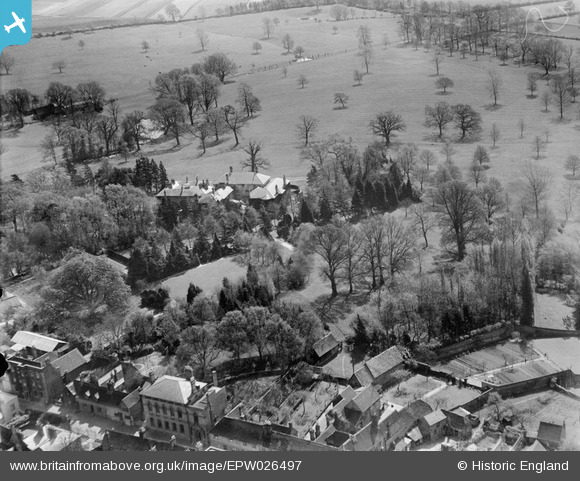
EPW026497 ENGLAND (1929). Ampthill House, Ampthill, 1929
© Copyright OpenStreetMap contributors and licensed by the OpenStreetMap Foundation. 2024. Cartography is licensed as CC BY-SA.
Nearby Images (6)
EPW026497

EPW026504

EPW035871

EPW035864

EPW026502

EPW026500

Details
| Title | [EPW026497] Ampthill House, Ampthill, 1929 |
| Reference | EPW026497 |
| Date | May-1929 |
| Link | |
| Place name | AMPTHILL |
| Parish | AMPTHILL |
| District | |
| Country | ENGLAND |
| Easting / Northing | 503712, 238063 |
| Longitude / Latitude | -0.48804934341165, 52.030845083215 |
| National Grid Reference | TL037381 |
Pins
 |
AmpthillJohn |
Tuesday 7th of October 2014 03:38:27 PM |
User Comment Contributions
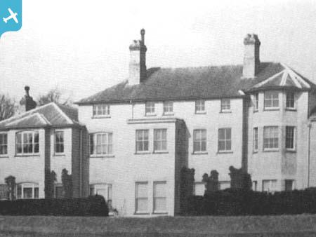
 Ampthill House Photograph 1 of 3 showing Ampthill House in the early 1900s (More photographs can be seen at ampthillimages.com - navigate to the Buildings A-B Album.) |
AmpthillJohn |
Tuesday 7th of October 2014 03:38:53 PM |
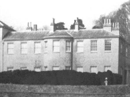 Ampthill House Photograph 2 of 3 showing Ampthill House in the early 1900s (More photographs can be seen at ampthillimages.com - navigate to the Buildings A-B Album.) |
AmpthillJohn |
Tuesday 7th of October 2014 03:36:58 PM |


