
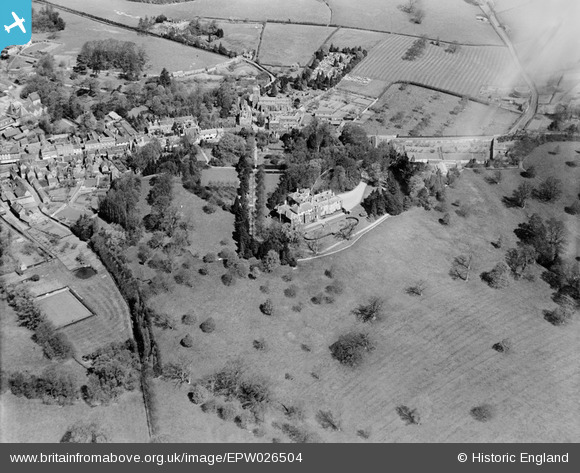
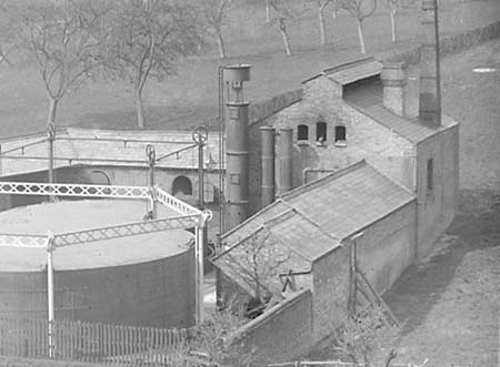
EPW026504 ENGLAND (1929). Ampthill House, Ampthill, 1929
© Copyright OpenStreetMap contributors and licensed by the OpenStreetMap Foundation. 2024. Cartography is licensed as CC BY-SA.
Nearby Images (5)
EPW026504

EPW026497

EPW035864

EPW035871

EPW026502

Details
| Title | [EPW026504] Ampthill House, Ampthill, 1929 |
| Reference | EPW026504 |
| Date | May-1929 |
| Link | |
| Place name | AMPTHILL |
| Parish | AMPTHILL |
| District | |
| Country | ENGLAND |
| Easting / Northing | 503741, 238035 |
| Longitude / Latitude | -0.48763522312759, 52.030587978837 |
| National Grid Reference | TL037380 |
Pins


User Comment Contributions
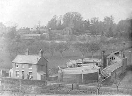 The Ampthill Gas Company built the Gasworks in 1849. Mostly demolished some years ago.Here is number 1 of 4 'ground level' photographs taken in the early 1900s |
AmpthillJohn |
Tuesday 7th of October 2014 03:08:17 PM |
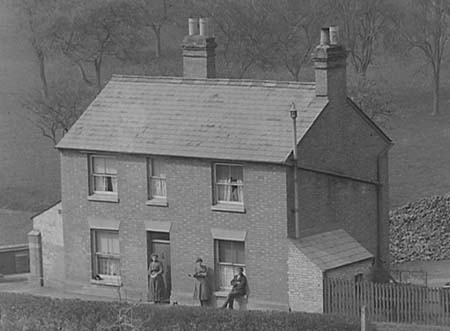 The Ampthill Gas Company built the Gasworks in 1849. Mostly demolished some years ago.Here is number 2 of 4 'ground level' photographs taken in the early 1900s |
AmpthillJohn |
Tuesday 7th of October 2014 03:07:43 PM |
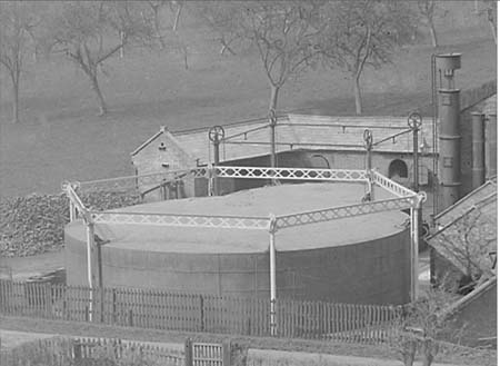 The Ampthill Gas Company built the Gasworks in 1849. Mostly demolished some years ago.Here is number 3 of 4 'ground level' photographs taken in the early 1900s |
AmpthillJohn |
Tuesday 7th of October 2014 03:07:04 PM |
 The Ampthill Gas Company built the Gasworks in 1849. Mostly demolished some years ago.Here is number 4 of 4 'ground level' photographs taken in the early 1900s |
AmpthillJohn |
Tuesday 7th of October 2014 03:05:32 PM |