
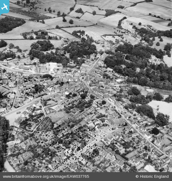
EAW037765 ENGLAND (1951). The town centre, Ampthill, 1951. This image has been produced from a damaged negative.
© Copyright OpenStreetMap contributors and licensed by the OpenStreetMap Foundation. 2024. Cartography is licensed as CC BY-SA.
Nearby Images (6)
EAW037765

EPW026500

EAW037766

EPW026496

EPW035864

EPW026502

Details
| Title | [EAW037765] The town centre, Ampthill, 1951. This image has been produced from a damaged negative. |
| Reference | EAW037765 |
| Date | 17-July-1951 |
| Link | |
| Place name | AMPTHILL |
| Parish | AMPTHILL |
| District | |
| Country | ENGLAND |
| Easting / Northing | 503454, 238088 |
| Longitude / Latitude | -0.49180158659936, 52.031117992434 |
| National Grid Reference | TL035381 |
Pins
 Gasometerman |
Tuesday 19th of June 2018 09:16:26 PM |


