
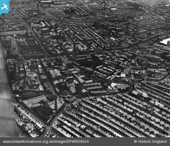
EPW004014 ENGLAND (1920). St John's Church and the town centre, Preston, 1920
© Copyright OpenStreetMap contributors and licensed by the OpenStreetMap Foundation. 2024. Cartography is licensed as CC BY-SA.
Nearby Images (9)
EPW004014

EPW004017

EPW004020

EAW023380

EPW004018

EPW055131

EPW004019

EPW055134

EPW055135

Details
| Title | [EPW004014] St John's Church and the town centre, Preston, 1920 |
| Reference | EPW004014 |
| Date | July-1920 |
| Link | |
| Place name | PRESTON |
| Parish | |
| District | |
| Country | ENGLAND |
| Easting / Northing | 354195, 429308 |
| Longitude / Latitude | -2.6948315523395, 53.757895814607 |
| National Grid Reference | SD542293 |
Pins
 Duck |
Wednesday 15th of April 2015 10:00:24 PM | |
Duck |
Wednesday 15th of April 2015 09:59:00 PM | |
Duck |
Wednesday 15th of April 2015 09:57:22 PM | |
Duck |
Wednesday 15th of April 2015 09:56:40 PM | |
Duck |
Wednesday 15th of April 2015 09:55:35 PM | |
Duck |
Sunday 12th of April 2015 10:34:10 PM | |
Duck |
Sunday 12th of April 2015 10:34:06 PM | |
 Class31 |
Tuesday 8th of January 2013 08:49:30 PM | |
Class31 |
Tuesday 8th of January 2013 08:48:11 PM | |
Class31 |
Tuesday 8th of January 2013 08:47:28 PM | |
Class31 |
Tuesday 8th of January 2013 08:46:25 PM | |
brianhayes |
Saturday 29th of September 2012 11:27:28 AM | |
brianhayes |
Saturday 29th of September 2012 11:24:13 AM |