
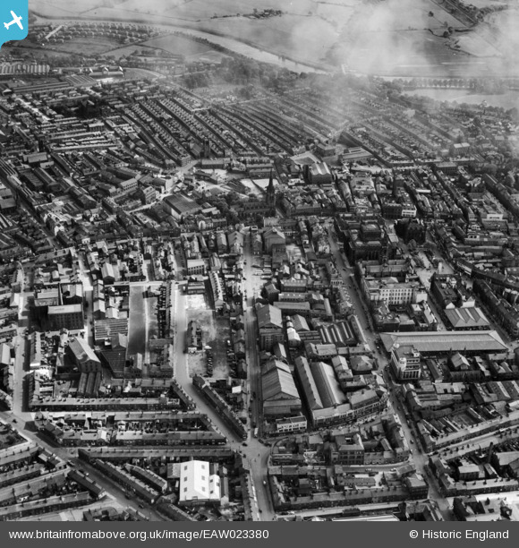
EAW023380 ENGLAND (1949). The city centre, Preston, 1949
© Copyright OpenStreetMap contributors and licensed by the OpenStreetMap Foundation. 2024. Cartography is licensed as CC BY-SA.
Nearby Images (11)
EAW023380

EPW004017

EPW055134

EPW055131

EPW004018

EPW004014

EPW061406

EPW061401

EPW061400

EPW061403

EPW004019

Details
| Title | [EAW023380] The city centre, Preston, 1949 |
| Reference | EAW023380 |
| Date | 25-May-1949 |
| Link | |
| Place name | PRESTON |
| Parish | |
| District | |
| Country | ENGLAND |
| Easting / Northing | 354168, 429471 |
| Longitude / Latitude | -2.6952652899268, 53.759358550924 |
| National Grid Reference | SD542295 |
Pins
 Duck |
Monday 13th of April 2015 05:54:32 PM | |
Duck |
Monday 13th of April 2015 05:53:40 PM | |
Duck |
Monday 13th of April 2015 05:53:04 PM | |
Duck |
Monday 13th of April 2015 05:52:25 PM | |
Duck |
Monday 13th of April 2015 05:51:22 PM | |
Duck |
Monday 13th of April 2015 05:50:43 PM | |
Duck |
Monday 13th of April 2015 05:49:20 PM | |
Duck |
Monday 13th of April 2015 05:46:23 PM | |
Duck |
Monday 13th of April 2015 05:45:57 PM | |
Duck |
Monday 13th of April 2015 05:45:27 PM | |
Duck |
Monday 13th of April 2015 05:43:36 PM | |
Romsey Mike |
Wednesday 7th of May 2014 09:32:14 PM | |
Romsey Mike |
Wednesday 7th of May 2014 09:31:35 PM | |
Romsey Mike |
Wednesday 7th of May 2014 09:28:51 PM | |
Romsey Mike |
Wednesday 7th of May 2014 09:25:06 PM | |
Romsey Mike |
Wednesday 7th of May 2014 09:18:57 PM | |
Romsey Mike |
Wednesday 7th of May 2014 09:17:01 PM | |
Romsey Mike |
Wednesday 7th of May 2014 09:14:09 PM | |
Romsey Mike |
Wednesday 7th of May 2014 09:12:28 PM | |
Romsey Mike |
Wednesday 7th of May 2014 09:09:16 PM | |
 Class31 |
Wednesday 29th of January 2014 02:24:53 PM |