
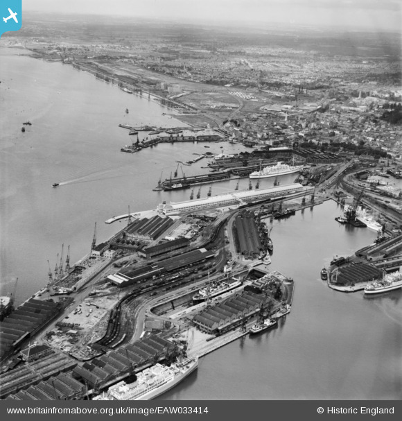
EAW033414 ENGLAND (1950). The Docks, Southampton, from the south-east, 1950
© Copyright OpenStreetMap contributors and licensed by the OpenStreetMap Foundation. 2024. Cartography is licensed as CC BY-SA.
Nearby Images (14)
EAW033414

EPW039724

EPW037412

EPW037411

EAW033432

EPW009067

EPW041071

EPW009064

EAW001369
 in Ocean Dock, Southampton, 1946")
EAW001345

EAW033411

EPW009068

EAW033409

EAW001346

Details
| Title | [EAW033414] The Docks, Southampton, from the south-east, 1950 |
| Reference | EAW033414 |
| Date | 10-October-1950 |
| Link | |
| Place name | SOUTHAMPTON |
| Parish | |
| District | |
| Country | ENGLAND |
| Easting / Northing | 442692, 109876 |
| Longitude / Latitude | -1.393010836949, 50.886238374798 |
| National Grid Reference | SU427099 |
Pins
 hrothery8 |
Sunday 7th of June 2020 06:13:04 PM | |
brianbeckett |
Friday 29th of May 2020 09:38:08 PM | |
brianbeckett |
Friday 29th of May 2020 09:37:41 PM |