
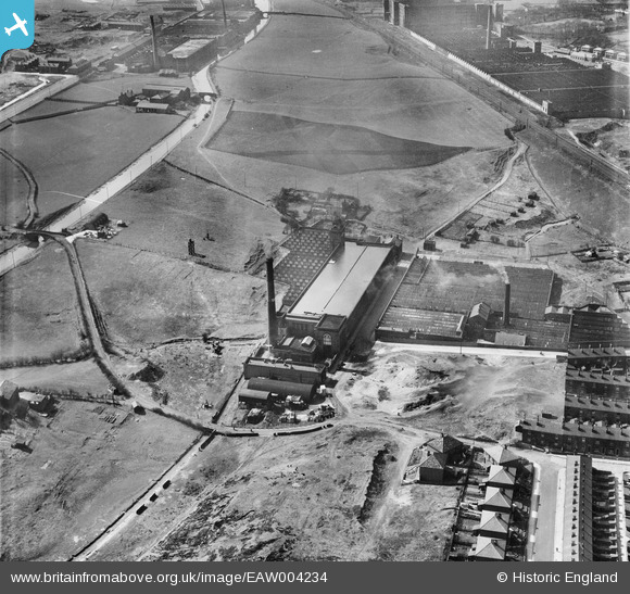
EAW004234 ENGLAND (1947). Valley Ring and Union Ring Cotton Mills at Stoneyfield, Rochdale, 1947
© Copyright OpenStreetMap contributors and licensed by the OpenStreetMap Foundation. 2024. Cartography is licensed as CC BY-SA.
Nearby Images (10)
EAW004234

EAW004233

EPW016796

EAW004232

EAW004235

EAW004236

EAW004230

EAW004231

EAW004237

EAW004238

Details
| Title | [EAW004234] Valley Ring and Union Ring Cotton Mills at Stoneyfield, Rochdale, 1947 |
| Reference | EAW004234 |
| Date | 9-April-1947 |
| Link | |
| Place name | ROCHDALE |
| Parish | |
| District | |
| Country | ENGLAND |
| Easting / Northing | 389281, 411741 |
| Longitude / Latitude | -2.1619992614171, 53.601886726086 |
| National Grid Reference | SD893117 |
