
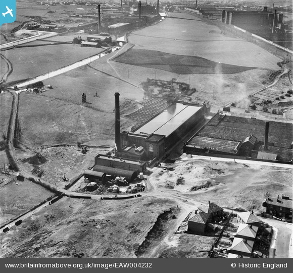
EAW004232 ENGLAND (1947). Valley Ring Cotton Mill at Stoneyfield, Rochdale, 1947
© Copyright OpenStreetMap contributors and licensed by the OpenStreetMap Foundation. 2024. Cartography is licensed as CC BY-SA.
Nearby Images (10)
EAW004232

EAW004235

EAW004230

EAW004231

EPW016796

EAW004234

EAW004233

EAW004236

EAW004237

EAW004238

Details
| Title | [EAW004232] Valley Ring Cotton Mill at Stoneyfield, Rochdale, 1947 |
| Reference | EAW004232 |
| Date | 9-April-1947 |
| Link | |
| Place name | ROCHDALE |
| Parish | |
| District | |
| Country | ENGLAND |
| Easting / Northing | 389321, 411767 |
| Longitude / Latitude | -2.1613956237531, 53.602121263961 |
| National Grid Reference | SD893118 |
Pins
 Sparky |
Thursday 28th of September 2017 10:21:43 PM | |
HILLARY |
Saturday 16th of May 2015 01:47:33 PM | |
HILLARY |
Saturday 16th of May 2015 01:47:03 PM | |
BobShut |
Monday 23rd of February 2015 05:21:38 PM | |
BobShut |
Monday 23rd of February 2015 05:19:14 PM | |
BobShut |
Monday 23rd of February 2015 05:17:37 PM | |
BobShut |
Monday 23rd of February 2015 05:16:57 PM |