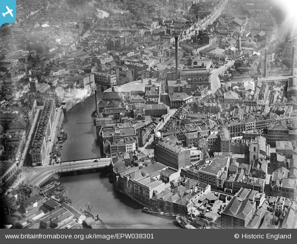
EPW038301 ENGLAND (1932). Industry around the Bristol Bridge, Bristol, 1932
© Hawlfraint cyfranwyr OpenStreetMap a thrwyddedwyd gan yr OpenStreetMap Foundation. 2024. Trwyddedir y gartograffeg fel CC BY-SA.
Delweddau cyfagos (26)
EPW038301

EPW038302

EPW034455

EPW034460
 and the Tramway Generating Station, Bristol, 1930")
EPW034452

EPW034459
 and the Tramway Generating Station, Bristol, 1930")
EPW034458

EPW034454
 and the Tramway Generating Station, Bristol, 1930")
EPW034453

EPW038304

EPW038300

EPW034451

EPW038303

EPW034457

EAW032256

EAW032257

EAW032259

EPW034450

EPW033498

EAW032254

EAW032258

EPW060117

EPW034456

EAW032255

EAW032260

EAW032261

Manylion
| Pennawd | [EPW038301] Industry around the Bristol Bridge, Bristol, 1932 |
| Cyfeirnod | EPW038301 |
| Dyddiad | June-1932 |
| Dolen | |
| Enw lle | BRISTOL |
| Plwyf | |
| Ardal | |
| Gwlad | ENGLAND |
| Dwyreiniad / Gogleddiad | 359162, 172921 |
| Hydred / Lledred | -2.5877941289205, 51.45330759108 |
| Cyfeirnod Grid Cenedlaethol | ST592729 |
Pinnau
 MB |
Monday 29th of August 2016 10:20:07 PM | |
MB |
Monday 29th of August 2016 10:19:05 PM | |
MB |
Monday 29th of August 2016 10:17:48 PM | |
 Class31 |
Saturday 14th of June 2014 09:42:24 PM | |
Class31 |
Monday 10th of June 2013 09:02:25 PM |