
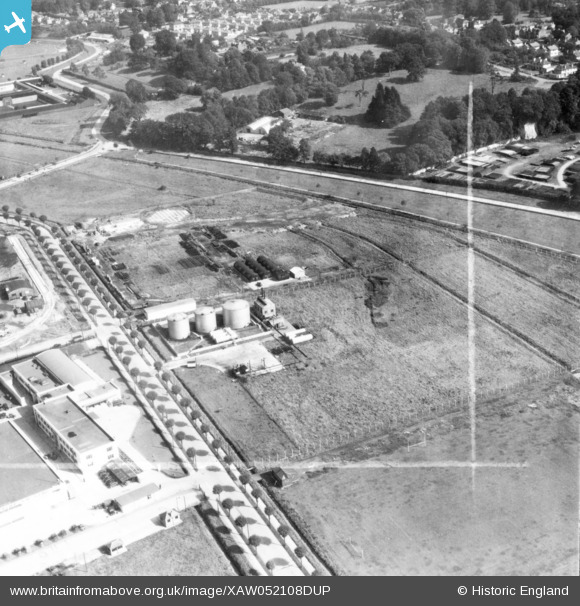
XAW052108DUP IRELAND (1953). Shell-Mex & BP Ltd., Cork, Eire, Cork, Cork, Ireland, 1953. Oblique aerial photograph taken facing East. This image was marked by Aerofilms Ltd for photo editing.
© Copyright OpenStreetMap contributors and licensed by the OpenStreetMap Foundation. 2026. Cartography is licensed as CC BY-SA.
Nearby Images (24)
XAW052108DUP

XAW052107DUP

XAW052106DUP

XAW045006

XAW045010

XAW045012

XAW045005

XAW045009

XAW052103

XAW045008

XAW045011

XAW040359

XAW040358

XAW045007

XAW045013

XAW040361

XAW052102

XAW027098

XAW027103

XAW027096

XAW027095

XAW027099

XAW040360

XAW027097

Details
| Title | [XAW052108DUP] Shell-Mex & BP Ltd., Cork, Eire, Cork, Cork, Ireland, 1953. Oblique aerial photograph taken facing East. This image was marked by Aerofilms Ltd for photo editing. |
| Reference | XAW052108DUP |
| Date | 7-October-1953 |
| Link | |
| Place name | CORK |
| Parish | IRELAND |
| District | |
| Country | IRELAND |
| Easting / Northing | -43340, 241838 |
| Longitude / Latitude | -8.447762, 51.898054 |
| National Grid Reference |
